Dunedin City CouncilCommunity profile
Skip to content

Dunedin City

What is profile.id

Dunedin City Community Profile

What is profile.id?

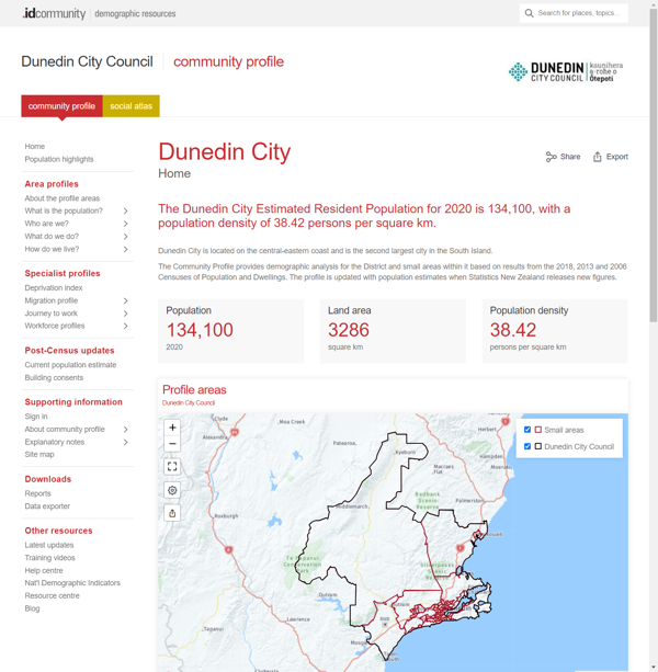
profile.id is a comprehensive socio-demographic profile of the Dunedin City and its suburbs / small areas. The Community Profile presents results from the 2018, 2013 and 2006 Census of Population and Dwellings.

The Community Profile enables analysis of population characteristics for different geographic areas and includes historical data to show how they have changed over time.

The Dunedin City Community Profile has been developed as a website linked to your Council website for ease of access by staff and the community, it can also be accessed directly at:

profile.idnz.co.nz/dunedin
Dunedin City Council

What information is included?

Dunedin City Community Profile is structured around four main questions. Within each of these, more detailed information is presented.

Population

  • Population
  • Service age groups
  • Five year age groups
  • Single year of age

Ethnicity

  • Ethnic groups
  • Māori descent
  • Birthplace
  • Languages spoken
  • Religion
  • Overseas arrivals

Education

  • Qualifications
  • Field of qualifications

Health

  • Smoking behaviour

Employment

  • Employment status
  • Industries
  • Occupations
  • Method of travel to work

Unpaid work

  • Unpaid work

Income

  • Individual income
  • Individual income quartiles
  • Household income
  • Household income quartiles
  • Sources of household income

Households

  • Family types
  • Household types
  • Household size

Dwellings

  • Dwelling type
  • Number of bedrooms
  • Telecommunication access
  • Number of cars

Housing tenure

  • Tenure overview
  • Housing rental payments
  • Housing rental quartiles

Migration profile

  • Migration summary
  • Migration by location

Journey to work

  • Workers' place of residence
  • Residents' place of work

Deprivation index

  • Deprivation index

For which geographic areas?

The Dunedin City Community Profile provides comprehensive data for the following geographic areas:

Small Area
  • Abbotsford
  • Andersons Bay
  • Arthur Street
  • Bathgate Park - Hillside-Portsmouth Drive
  • Belleknowes
  • Brighton
  • Broad Bay-Portobello
  • Brockville
  • Bucklands Crossing
  • Bush Road
  • Calton Hill
  • Campus North
  • Campus South
  • Campus West
  • Caversham
  • Concord
  • Corstorphine
  • Dunedin Central - Harbourside
  • East Taieri
  • Fairfield
  • Fernhill
  • Forbury
  • Gardens
  • Glenleith
  • Green Island
  • Halfway Bush
  • Helensburgh
  • Kaikorai-Bradford
  • Kenmure
  • Kew
  • Macandrew Bay-Company Bay
  • Māori Hill
  • Maryhill
  • Momona
  • Mornington
  • Mosgiel Central
  • Mosgiel East
  • Mount Cargill
  • Musselburgh
  • Normanby
  • North East Valley Chingford
  • North East Valley Knox
  • Opoho
  • Otago Peninsula
  • Pine Hill-Dalmore
  • Port Chalmers
  • Ravensbourne-St Leonards
  • Roseneath-Sawyers Bay
  • Roslyn
  • Royal Terrace
  • Saddle Hill-Chain Hills
  • Seddon Park
  • Shiel Hill
  • St Clair
  • St Kilda North
  • St Kilda South
  • Strath Taieri
  • Taieri
  • Tainui
  • Waikouaiti
  • Wakari
  • Waldronville
  • Waverley
  • Benchmarks
  • Dunedin City
  • New Zealand
  • Environment Canterbury
  • Abbotsford
  • Andersons Bay
  • Aramoana
  • Balmacewen
  • Belleknowes
  • Brighton
  • Broad Bay-Portobello
  • Brockville
  • Bush Road
  • Caledonian
  • Caversham
  • Company Bay
  • Concord
  • Corstorphine East
  • Corstorphine West
  • East Taieri
  • Evansdale
  • Fairfield
  • Fernhill
  • Forbury
  • Forrester Park
  • Glenleith
  • Green Island
  • Halfway Bush
  • Harbourside
  • Helensburgh
  • High St-Stuart St
  • Hyde
  • Inlet-Dunedin City Bays
  • Inlet-Otago Harbour
  • Inner Peninsula
  • Kaikorai Hill
  • Karitane
  • Kenmure
  • Macandrew Bay
  • Māori Hill
  • Middlemarch
  • Mornington
  • Mosgiel East
  • Mosgiel South
  • Musselburgh
  • North Dunedin
  • North East Valley
  • Opoho
  • Otago University
  • Outram
  • Pine Hill
  • Port Chalmers
  • Ravensbourne
  • Roslyn North
  • Roslyn South
  • Saddle Hill
  • Sawyers Bay
  • South Dunedin
  • St Clair
  • St Kilda Central
  • St Kilda East
  • St Kilda West
  • St Leonards-Blanket Bay
  • Strath Taieri
  • Stuart St-Frederick St
  • Taiaroa-Cape Saunders
  • Taieri
  • Vauxhall
  • Waikouaiti
  • Waitati
  • Wakari
  • Waldronville
  • Warrington
  • Wingatui
  • Woodhaugh
  • Wyllies Crossing
  • How can I access Dunedin City Community Profile?

    The Dunedin City Community Profile can be accessed via the Dunedin City website or at:

    profile.idnz.co.nz/dunedin

    v20.11.10-1.0.0